6 Texas Daytrips to Drive Away the Winter Blues
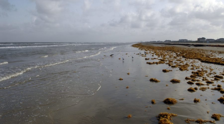
Surfside Beach in the Brazosport area is a recreation area for swimming, sailing, surf fishing, camping, shell collecting and bird watching. Photo by Kevin B. Stillman.
Hop in your car and social distance your way through these less-traveled parts of Texas
Written by:
Joe Nick Patoski Published: December 30, 2020 at 2:59 pm
The Upper Coastal Loop of Galveston Bay
Directions (starting from Houston): Start by taking Exit 810 on Interstate 10, about 40 miles east of downtown Houston. Head south on Farm-to-Market Road 563 to Anahuac and pick up Farm-to-Market Road for 10 miles to Double Bayou. Drive south on Farm-to-Market Road 562 for 17 miles to Smith Point; or from Double Bayou, take FM 563 and Farm-to-Market Road 1985 to the Anahuac Wildlife Refuge, Smith Oaks, and High Island, 25 miles away.
Time: Five hours
It may be the second largest bay complex in the United States, but too often Galveston Bay is taken for granted, or worse, ignored. Rectify that with a driving tour of the east side of Texas’ big bay, the beginning of a coastal circumnavigation of Houston.
This journey goes through Anahuac, the self-proclaimed Alligator Capital of Texas on the banks of the Trinity River, and Double Bayou, site of an historic juke joint in a rural African American community. Venture to Smith Point to overlook the least-peopled part of Galveston Bay, or visit Anahuac Wildlife Refuge, Smith Oaks, and High Island, three sites that offer some of the finest birding and wildlife viewing on the continent, rife with nature trails.
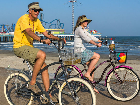
Running 25 miles from High Island down the Bolivar Peninsula is the Galveston ferry landing, where you can stay in your car and take a free ride across the mouth of Galveston Bay. Once across, detour through the Strand Historic District and Broadway Street to admire the elaborate architecture of two centuries ago, then head for Seawall Boulevard to start following the Gulf again on the left.
Getting through Galveston can be a slow crawl, especially on weekends. But once you’ve reached Galveston Island State Park—a fine stopping point if you’ve reserved a timed day pass online in advance—the road opens up as Termini-San Luis Pass Road.
San Luis Pass marks the end of Galveston Island and the beginning of Follet’s Island and Surfside. A county park across the bridge is a good spot to pause before continuing down the beach on the road that is now the Bluewater Highway, ending 14 miles later at Surfside Beach,arguably the most unassuming coastal village in Texas, near the mouth of the Brazos River.
Surfside offers walking along the Bluewater Highway Nature Trail or the Bird and Butterfly Trail, a playground at Jetty Park, and takeout options at places such as The Red Snapper Inn, La Taqueria de Surfside, Jetty Shack, or the Beach Front Deck Bar and Grill. From Surfside it’s just 8 miles on State Highway 332 to Nolan Ryan Expressway and the road back to Houston.